Drone Mapping
Drone Mapping Explained: Technology, Accuracy and Applications Across Industry
Across construction, infrastructure, utilities and energy sectors, access to accurate and timely site intelligence has become central to safe, efficient project delivery. Increasingly, organisations are incorporating drone mapping into their operational strategies to enhance visibility, reduce risk and improve decision-making.
While aerial surveys are not new, modern drone mapping has evolved significantly beyond basic photography. Today, it provides structured, measurable and geo-referenced datasets that can support engineering design, asset management planning and compliance reporting.
For organisations responsible for managing sites, structures or portfolios of assets, understanding what drone mapping entails — and what standards should be expected — is essential.
This article provides a comprehensive overview of drone mapping, including how it works, the different survey options available, UK regulatory requirements, expected deliverables and how UAV capability integrates with IRATA-led rope access services.
What Is Drone Mapping?
At its core, drone mapping is the structured process of capturing aerial imagery and sensor data using an unmanned aerial vehicle (UAV), then processing that data into measurable digital outputs.
The critical distinction is that drone mapping is not simply about capturing images. It produces geo-referenced outputs tied to real-world coordinate systems. This allows distances, areas, elevations and volumes to be measured with confidence and integrated into engineering or GIS platforms.
A typical drone mapping operation involves a pre-planned flight pattern designed to ensure consistent overlap between images. The drone captures hundreds or thousands of high-resolution photographs. These are then processed using photogrammetry software, which identifies shared reference points and reconstructs them into accurate digital models.
The outputs may include orthomosaic site maps, three-dimensional surface models, digital elevation datasets, point clouds and volumetric calculations. These geospatial datasets align with recognised UK coordinate systems maintained by Ordnance Survey, ensuring compatibility with wider engineering, GIS and asset management workflows.
For infrastructure and asset stakeholders, this translates into reliable site intelligence that can inform planning, reporting and maintenance strategy.
The Technologies Behind Drone Mapping
Modern drone mapping is underpinned by a combination of hardware precision and advanced data processing software. While the operational process may appear straightforward, the reliability and accuracy of outputs depend on several integrated technologies working in coordination. Understanding these foundations helps differentiate professional-grade drone mapping from basic aerial image capture.
Photogrammetry remains the most widely used methodology in drone mapping. By analysing the geometric relationships between overlapping photographs, specialist software reconstructs three-dimensional representations of the surveyed area. This technique is particularly suited to construction sites, stockpile measurement, façade surveys and terrain modelling.
In certain environments, LiDAR (Light Detection and Ranging) may be used. Rather than relying solely on visual imagery, LiDAR emits laser pulses to measure distances with exceptional precision. LiDAR-enabled drone mapping is especially valuable in areas with vegetation cover or where highly detailed elevation modelling is required.
Accuracy is further enhanced through RTK (Real-Time Kinematic) or PPK (Post-Processed Kinematic) correction systems. These significantly reduce positional tolerance, often achieving centimetre-level precision when combined with ground control points. For engineering or contractual measurement applications, the precision of drone mapping is fundamental.
Types of Drone Mapping Surveys
Different projects require different outputs, and professional drone mapping is rarely a one-size-fits-all service. The type of survey commissioned will depend on site conditions, operational objectives and the level of detail required for planning or compliance purposes. Selecting the appropriate drone mapping methodology ensures that captured data aligns with practical decision-making needs rather than generating unnecessary technical complexity.
Topographical Surveys
Topographical drone mapping surveys provide detailed elevation and contour information across large areas. These surveys are commonly used during early project stages to inform site design, drainage planning and access strategy.
Because large areas can be captured rapidly, drone mapping reduces the time required to gain a comprehensive understanding of terrain conditions, particularly on complex or uneven sites.
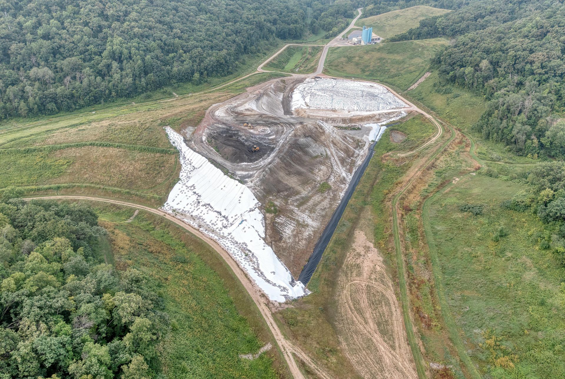
Volumetric and Stockpile Measurement
In quarrying, waste management and port environments, drone mapping is frequently used to calculate material volumes.
By generating accurate 3D models of stockpiles, organisations can obtain repeatable measurements for reporting and inventory management. Compared to manual measurement methods, drone mapping significantly reduces personnel exposure to heavy plant operations while improving reporting consistency.
Building and Roof Surveys
For building owners and facilities teams, drone mapping enables high-resolution inspection of roofs and façades without the immediate need for scaffolding or MEWPs.
Captured datasets support condition assessments, planned maintenance scheduling, defect identification and insurance documentation. Where physical inspection or repair is required, UAV data can be used to plan targeted rope access deployment, reducing unnecessary exploratory access.
Drone Mapping in Renewable Energy and Wind Turbine Maintenance
Within the renewable energy sector, drone mapping and UAV surveys are increasingly integrated into asset management strategies, particularly for wind turbine blade inspection and maintenance planning.
As UK wind generation capacity continues to expand, reflected by industry bodies such as RenewableUK, structured inspection and lifecycle maintenance planning are becoming increasingly critical. Wind turbine blades operate in demanding environmental conditions. Leading edges, lightning receptors and protective coatings are exposed to sustained wind loading, moisture and airborne particulates. Over time, erosion, cracking and surface degradation can develop.
Modern drone mapping provides a structured preliminary assessment before technicians are mobilised. High-resolution UAV surveys capture detailed imagery of blade surfaces, identify visible damage patterns and map defect locations relative to blade orientation.
From a planning perspective, drone mapping enables pre-intervention scoping. Rather than deploying rope access teams without confirmed defect data, survey outputs define likely repair requirements in advance. This supports more accurate scheduling, material preparation and downtime planning.
Repeated drone mapping surveys allow deterioration trends to be monitored over time, supporting preventative maintenance strategies and improving long-term asset reliability.
Where repair work is required, IRATA-qualified rope access technicians can be deployed directly to mapped defect areas, ensuring controlled and efficient delivery.
Drone Mapping Regulatory Framework in the UK
All commercial drone mapping operations within the United Kingdom must comply with regulations set by the Civil Aviation Authority (CAA).
The Civil Aviation Authority regulates unmanned aircraft operations through a structured framework governing operator registration, operational authorisation, pilot competency and airspace permissions. Commercial UAV operators are required to demonstrate appropriate training, maintain operational documentation and carry adequate insurance cover.
Industrial and infrastructure environments can introduce additional operational considerations, including restricted airspace, proximity to occupied buildings and coordination with ongoing site activities. Professional drone mapping operations must therefore incorporate structured flight planning, formal risk assessment and defined safety procedures as part of their deployment methodology.
In addition to aviation compliance, data governance is an increasingly important consideration. Aerial survey datasets may capture sensitive infrastructure information, meaning secure storage, controlled access and structured reporting processes are essential components of responsible drone mapping practice.
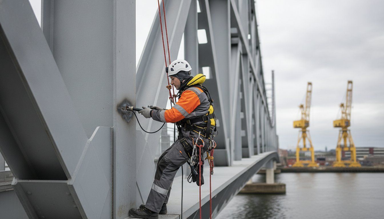
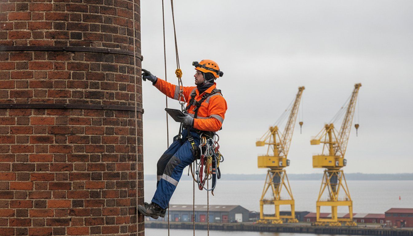
Drone Mapping and IRATA Rope Access: Complementary Capabilities
In complex environments, data capture and physical intervention are rarely isolated activities. While drone mapping provides high-level visibility and measurable insight, many inspection and maintenance programmes ultimately require controlled access to structures.
UAV surveys provide rapid visual and measurable intelligence across large or elevated assets. However, regulatory inspections, NDT testing and remedial works often require hands-on access delivered by qualified technicians operating under internationally recognised standards such as those set by IRATA International.
Dangle’s UAV capability operates alongside IRATA-compliant rope access teams, allowing digital survey and physical intervention to function as a unified workflow.
For readers seeking further context on rope access governance and accreditation frameworks, the previous article on IRATA accreditation provides essential insight.
UAV Accuracy, Data Processing and Deliverables
The practical value of drone mapping is determined not only by how data is captured, but by how it is processed, verified and presented. For organisations relying on a UAV survey outputs to inform engineering, budgeting or compliance decisions, clarity and accuracy in reporting are critical.
Following data acquisition, imagery is uploaded into specialist software platforms. These platforms align photographs, generate dense point clouds and construct structured 3D models suitable for engineering analysis. Deliverables from a professional drone mapping project may include orthomosaic maps, interactive 3D models, CAD-compatible files and structured reporting outputs.
When delivered to professional standards,
drone mapping provides data suitable for integration into asset management and design workflows.
Why Choose Dangle for Drone Mapping?
Dangle supports organisations across Belfast and Northern Ireland with professional drone mapping services designed for real-world decision-making — not just nice aerial photos. We help clients capture reliable site data quickly, safely, and with minimal disruption to operations.
Our drone mapping work is planned and delivered with a focus on accuracy, consistency, and usable outputs. Depending on your project, we can provide mapping deliverables such as orthomosaic maps, 3D models, point clouds and elevation data to support surveying, planning, progress tracking, and asset management.
Because we’re locally based, we can respond quickly for repeat surveys, phased projects, and ongoing monitoring — helping you compare change over time and keep stakeholders aligned with up-to-date site visuals and measurements.
If you’d like to discuss your site and the best approach for your drone mapping requirements, get in touch — we’ll recommend a practical scope and outputs that match how you actually need to use the data.
Drone Mapping FAQ's
What is the difference between drone mapping and drone photography?
Drone photography is primarily visual. Drone mapping creates measurable, georeferenced survey data (e.g., orthomosaics, 3D models, point clouds). Our drone mapping is delivered by a fully qualified drone pilot, supported by CEng chartered civil engineers.
How accurate is drone mapping?
Drone photography is primarily visual. Drone mapping creates measurable, georeferenced survey data (e.g., orthomosaics, 3D models, point clouds). Our drone mapping is delivered by a fully qualified drone pilot, supported by CEng chartered civil engineers.
When should drone mapping be used alongside rope access?
Drone mapping is ideal for the initial overview of large, complex, or elevated structures, helping identify defects and define the scope before technicians are mobilised. Where close-up inspection, testing, or repair is needed, rope access can then be deployed in a targeted, controlled way. Used together, drone mapping and rope access create a more efficient inspection approach — improving planning, reducing time at height, and focusing access where it’s genuinely required.
How often should drone mapping surveys be carried out?
The frequency of drone mapping depends on project phase and asset risk profile. Construction sites may require regular surveys for progress monitoring, while infrastructure or renewable assets may use periodic surveys to track deterioration and inform maintenance planning.
What’s the difference between RTK and PPK in drone mapping?
Real Time Kinematic (RTK) applies corrections in real time during the flight; Post-Processed Kinematic (PPK) applies corrections after the flight during processing. Both are used to improve accuracy.
Do I need ground control points (GCPs) for drone mapping?
Not always. RTK/PPK can reduce the need for GCPs, but check points/GCPs can still be used to verify accuracy and improve confidence for certain sites.
What sites are best suited to drone mapping?
Drone mapping works best on sites where you need a fast, measurable overview of an area — especially where access is difficult or the site changes regularly. It’s well suited to construction and redevelopment sites, quarries and stockpiles (volumetrics), land and topographic surveys, infrastructure corridors (roads, rail, utilities), and large roofs or industrial estates. It’s also ideal for progress tracking, creating a repeatable record of site change over time.
Is LiDAR and Drone Mapping the same thing?
LiDAR can be used for drone mapping, but it isn’t the same thing as “drone mapping” in the general sense.
"Drone mapping" is the umbrella term for creating measurable maps/models from drones. The two main ways to do it are:
- Photogrammetry mapping: uses overlapping photos to build orthomosaics, 3D models, point clouds, and elevation models.
- LiDAR mapping: uses a laser scanner to directly measure distances and produce a LiDAR point cloud (and derived surfaces like Digital Elevation Model (DEM) / Digital Terrain Model (DTM).
Contact Us
We'd Love a Share...
Recent Blog Post's